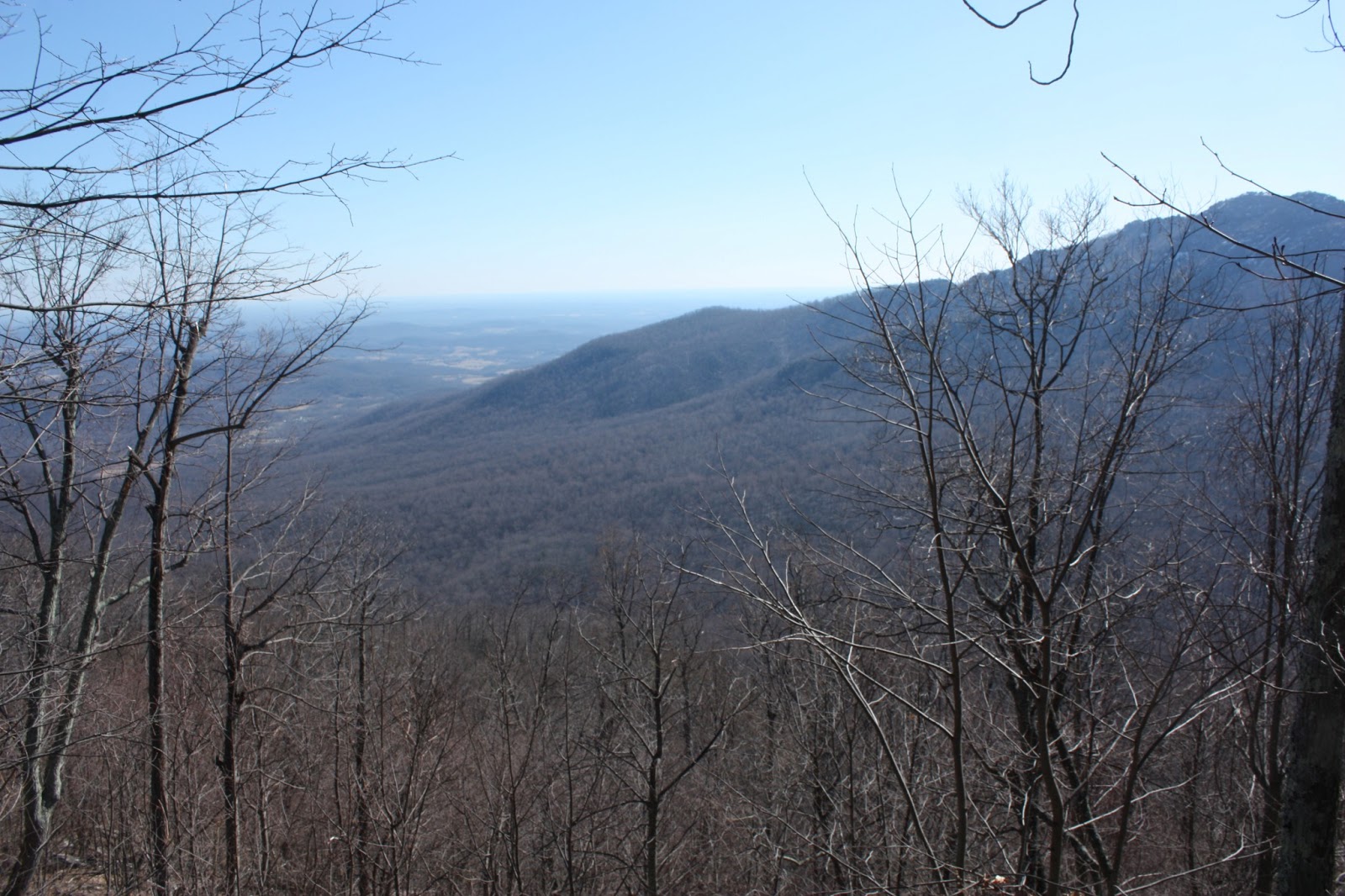
 |
| View down Berry Hollow from Robertson Mountain |
Difficulty: Moderate-Strenuous
Access: $8 per person Shenandoah National Park entrance fee, or purchase a $30 annual pass beforehand for small groups
This scenic loop around Robertson Mountain is a good substitute hike for Old Rag Mountain, which lies right across Weakley Hollow. Robertson Mountain stands one foot taller than Old Rag Mountain and lacks a fun rock scramble, but the peak still delivers astonishing views and Robertson Mountain does have the claim of one of the steepest sections of trail in the park. The Robertson Mountain Trail packs in over 1700 feet of elevation gain in about a mile and a half.
I hiked this trail on a winter morning with a friend, heading out from Charlottesville at a reasonable hour on US 29. Along the way, my friend informed me of the many things along US 29 I had missed because I'm too busy paying attention to the road- Bamboo House, a restaurant between Hollymead and Ruckersville, and cows? I turned left off of US 29 onto US 29 business at Madison, following Main St. through the town of Madison and turning left onto VA 231 north just after passing through town. 231 is one of my favorite roads: as we drove down it, we passed incredibly scenic Virginia farmland with views of Doubletop, Old Rag, and other Blue Ridge peaks. After passing Banco, I turned left onto 670, which I took past Criglersville to Syria: at Syria, I turned right onto 600, following signs for the Whiteoak Canyon Trailhead. I continued up 600 into Berry Hollow, the narrow valley between Old Rag and the mountains of the Blue Ridge crest. We crossed the Robinson River and passed the Whiteoak Canyon trailhead before the road narrowed significantly to the point where probably only one car could get by at a time. This narrow road climbed uphill and dead-ended in the parking lot for the Berry Hollow Trailhead. We parked here to start the hike.
The first part of the hike continued following the Berry Hollow Fire Road, climbing up toward Old Rag Saddle. A creek descended Berry Hollow to our right as we ascended the trail; we passed through sections of the road that were slightly frozen over. A little under a mile from the trailhead, we came to the Old Rag Saddle and the junction with the Old Rag Fire Road and the Old Rag Saddle Trail. We continued straight on the Weakley Hollow Fire Road, beginning a fairly gentle descent into Weakley Hollow with views of Old Rag through the trees to our right and many leafless tulip poplars above us. Snow from a recent storm remained on the trail: we could see many animal tracks through the snow.
 |
| Animal prints in the snow |
About 1.2 miles down the Weakley Hollow Fire Road from the Old Rag Saddle, we came to the junction for the Robertson Mountain Trail, right before the fire road made a turn to the right. The Robertson Mountain Trail started by entering and following a stream valley, but a sharp turn threw the trail towards the ridge. The climb was immediate and steep, and soon we were huffing as we made our way up the ridge. The trail was sometimes rocky and all times steep. As we climbed higher on the ridge, we began to see more snow along the trail. Luckily, the trail itself remained either snow free or only light coated with snow during the first part of the ascent, and there was no ice on the trail.
 |
| The very steep Robertson Mountain Trail |
About two-thirds the way into this steep ascent, we passed a large boulder to the right of the trail. Climbing onto this boulder, I found a limited view of Old Rag and the Piedmont.
 |
| View into the Piedmont, 2/3 way up Robertson Mountain |
Towards the top, the trail began leveling out. The trail began following the gentler summit ridge, and eventually swung to the right (northeast) of the summit. Here, there was quite a bit of snow left- two or three inches, in some places.
 |
| Snowy trail on Robertson Mountain |
There are no views directly from the trail, but there is one unsigned but still blue-blazed spur trail that breaks off to the left near the high point of Robertson Mountain. The spur leads first to a campsite with a fire ring atop the mountain and then to a viewpoint on an open granite slab overlooking Berry Hollow. The view is quite stunning: Old Rag is visible to the left, Doubletop, Fork, and Jones are visible to the south, and Hawksbill and Stony Man are visible to the east. Directly to the south, the cut of Whiteoak Canyon is visible, even if none of the waterfalls are; and further up in the view, a pond in Berry Hollow is quite eye-catching. We enjoyed the view and lunched here; unfortunately, it was quite windy so we didn't stay for the longest time.
 |
| Hawksbill from Robertson Mountain |
Before leaving the summit area, we checked out a boulder behind the south-facing viewpoint that gave a somewhat limited view to the north. While it's not as grand, this view is remarkable in that Mt. Marshall and the Peak, which are far away in the north district, are still visible from here.
 |
| View north of Mt. Marshall and the Peak from Robertson |
From the summit, we continued further on the Robertson Mountain Trail. The trail then began a fairly steep descent- though this section was not nearly as steep as what we came up! After about a half mile, we came to the junction with the Old Rag Fire Road. We turned left here and followed the Old Rag Fire Road back towards the saddle. The fire road was iced over in many spots, making walking along it a little difficult and a little slippery. There was some elevation change: at first a descent, then a slight ascent before a descent down to Old Rag Saddle. At one point on the fire road, about a half mile past the junction, we were able to look up and see the rocks that we had been standing at on Robertson Mountain just half an hour before.
The fire road winded a little more than 2 miles to reach Old Rag saddle. During the final descent to the saddle, there were many views of the rocky summit of Old Rag. After returning to the saddle, we turned right and followed the Berry Hollow Fire Road back downhill 0.8 to the parking area, finishing the hike.
 |
| Old Rag from the Old Rag Fire Road |
No comments:
Post a Comment